
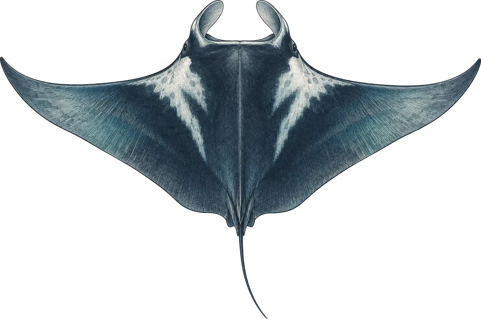
giant (oceanic) manta
Jul–NovEl Morro, Los Anegados, Marietas Islands, El Chimo
Watch the blue off pinnacles and cleaning stations at 15 to 30 m.1
Seasonal; sources disagree on the peak months.
The best time to dive Puerto Vallarta is July to November, when the water is 28 to 30 °C, visibility is best and the offshore pinnacles are reachable. August to October is storm season, with a storm nearby in up to 40% of years. I'd go in November.
Operators say: July to November for warm, clear water and the offshore pinnacles; winter for humpbacks. Our data rates November to May best, dry and calm, and August to October worst for rain and storms; operators find winter water cooler, greener and rougher offshore.
111 km across · coastline from Natural Earth 10m
Puerto Vallarta sits on Banderas Bay, Mexico's largest bay, shared by Jalisco and Nayarit. Day boats run two-tank trips from the city. Inside the bay, Los Arcos marine park, Majahuitas and Colomitos are 20 to 45 minutes away and suit beginners. The Marietas Islands are about an hour out, and the offshore pinnacles of El Morro, Los Anegados and La Corbeteña take 75 minutes to two hours. Those offshore sites are for experienced divers: depths of 15 to 43 m, caves and tunnels, and current.
The seasons trade off. From about June to November the water reaches 29 to 30 °C and visibility is at its best, and operators rate the northern offshore sites best then, though August to October is the rainy and storm season. From late November to May cold fronts, swell and spring winds make exposed sites unpredictable and the water can fall to 17 °C, or about 13 °C at depth, but humpback whales are in the bay from about December to March.
Hover a month to isolate it.
| January | February | March | April | May | June | July | August | September | October | November | December | |
|---|---|---|---|---|---|---|---|---|---|---|---|---|
| Conditions | Excellent | Excellent | Excellent | Excellent | Excellent | Moderate | Good | Poor | Poor | Poor | Excellent | Excellent |
| Water temp (°C) | 25 | 25 | 24 | 24 | 26 | 28 | 30 | 30 | 30 | 30 | 29 | 27 |
| Visibility (m) | 5–15 | 5–15 | 5–15 | 5–15 | 5–15 | 10–20 | 15–25 | 15–25 | 10–20 | 10–20 | 15–25 | 10–20 |
| Marine life | Busy | Steady | Busy | Busy | Busy | Steady | Busy | Steady | Busy | Steady | Busy | Busy |
| Best time | Peak | Peak | Peak | Peak | Peak |
Long-term averages, 2016–2025. Visibility is estimated from satellite chlorophyll-a. Water temperature is the surface mean; it is cooler at depth.
Diving conditionsThe wind is up. It rains more.
Diving conditionsThe wind eases. It rains less.
Marine lifeCalifornia sea lion (hit-or-miss), Munk's mobula (hit-or-miss), Southern elephant seal (hit-or-miss) peak at Puerto Vallarta / Banderas in these months.
7,155 underwater observation records · 32 surveyed years of ocean data · 10 years of sea temperature
Dashed: monthly average. Band: eight days in ten.
10th to 90th percentile rangemonthly mean
Seas top 1.5 m on 14% of days. Enough to cancel a day boat
Gusts over 40 km/h, about where a day boat stays in port
3 of them bring heavy rain
| Month | Swell | Gusts over 40 km/h | Wet days | Heavy rain | Air | Daylight |
|---|---|---|---|---|---|---|
| Jan | 1.7 m | 0% | 1 | 0 | 26 °C | 10.9 h |
| Feb | 1.5 m | 0% | 2 | 1 | 26 °C | 11.3 h |
| Mar | 1.6 m | 0% | 1 | 0 | 26 °C | 11.9 h |
| Apr | 1.4 m | 0% | 0 | 0 | 27 °C | 12.5 h |
| May | 1.5 m | 0% | 1 | 0 | 28 °C | 13.0 h |
| Jun | 1.8 m | 0% | 10 | 4 | 29 °C | 13.2 h |
| Jul | 1.5 m | 0% | 20 | 6 | 31 °C | 13.1 h |
| Aug | 1.6 m | 1% | 25 | 8 | 30 °C | 12.7 h |
| Sep | 1.9 m | 0% | 24 | 10 | 30 °C | 12.1 h |
| Oct | 2.1 m | 1% | 16 | 5 | 30 °C | 11.5 h |
| Nov | 1.4 m | 0% | 3 | 0 | 29 °C | 11.0 h |
| Dec | 1.5 m | 0% | 2 | 0 | 27 °C | 10.7 h |
Swell is the rough end of the month: nine days in ten come in under it. Sea temperature covers 10 years, waves 4.
Darker is better, against this site's own year. Pick a month for its weeks.
| Week 1 | ||||||||||||
|---|---|---|---|---|---|---|---|---|---|---|---|---|
| Week 2 | ||||||||||||
| Week 3 | ||||||||||||
| Week 4 |
| Week | Conditions | Water | Swell | Wind | Rain chance |
|---|---|---|---|---|---|
| Week 1 | Excellent | 26 °C | 1.8 m | 14 km/h | 7% |
| Week 2 | Excellent | 25 °C | 1.7 m | 14 km/h | 3% |
| Week 3 | Excellent | 25 °C | 1.7 m | 15 km/h | 3% |
| Week 4 | Excellent | 25 °C | 1.5 m | 16 km/h | 7% |
| Week 1 | Excellent | 25 °C | 1.6 m | 15 km/h | 5% |
| Week 2 | Excellent | 25 °C | 1.5 m | 16 km/h | 8% |
| Week 3 | Excellent | 25 °C | 1.5 m | 17 km/h | 8% |
| Week 4 | Excellent | 25 °C | 1.6 m | 16 km/h | 3% |
| Week 1 | Excellent | 24 °C | 1.5 m | 16 km/h | 2% |
| Week 2 | Excellent | 24 °C | 1.5 m | 16 km/h | 2% |
| Week 3 | Excellent | 24 °C | 1.6 m | 16 km/h | 2% |
| Week 4 | Excellent | 24 °C | 1.6 m | 16 km/h | 1% |
| Week 1 | Excellent | 24 °C | 1.5 m | 15 km/h | 1% |
| Week 2 | Excellent | 24 °C | 1.4 m | 15 km/h | 0% |
| Week 3 | Excellent | 24 °C | 1.4 m | 15 km/h | 0% |
| Week 4 | Excellent | 25 °C | 1.4 m | 15 km/h | 0% |
| Week 1 | Excellent | 25 °C | 1.5 m | 15 km/h | 1% |
| Week 2 | Excellent | 26 °C | 1.6 m | 15 km/h | 1% |
| Week 3 | Excellent | 26 °C | 1.5 m | 15 km/h | 1% |
| Week 4 | Excellent | 27 °C | 1.5 m | 15 km/h | 6% |
| Week 1 | Good | 27 °C | 1.7 m | 16 km/h | 12% |
| Week 2 | Good | 28 °C | 1.8 m | 16 km/h | 23% |
| Week 3 | Moderate | 28 °C | 1.7 m | 15 km/h | 39% |
| Week 4 | Poor | 29 °C | 1.7 m | 15 km/h | 52% |
| Week 1 | Moderate | 29 °C | 1.7 m | 14 km/h | 58% |
| Week 2 | Good | 30 °C | 1.6 m | 13 km/h | 61% |
| Week 3 | Good | 30 °C | 1.4 m | 13 km/h | 67% |
| Week 4 | Good | 30 °C | 1.4 m | 13 km/h | 73% |
| Week 1 | Poor | 30 °C | 1.6 m | 13 km/h | 78% |
| Week 2 | Poor | 30 °C | 1.7 m | 13 km/h | 80% |
| Week 3 | Poor | 30 °C | 1.6 m | 13 km/h | 78% |
| Week 4 | Poor | 30 °C | 1.7 m | 12 km/h | 80% |
| Week 1 | Poor | 30 °C | 2.0 m | 12 km/h | 80% |
| Week 2 | Poor | 30 °C | 2.0 m | 12 km/h | 81% |
| Week 3 | Poor | 30 °C | 1.7 m | 13 km/h | 79% |
| Week 4 | Poor | 30 °C | 1.7 m | 13 km/h | 78% |
| Week 1 | Poor | 30 °C | 2.2 m | 13 km/h | 72% |
| Week 2 | Poor | 30 °C | 2.4 m | 13 km/h | 57% |
| Week 3 | Poor | 30 °C | 2.0 m | 14 km/h | 48% |
| Week 4 | Moderate | 30 °C | 1.7 m | 14 km/h | 35% |
| Week 1 | Good | 29 °C | 1.4 m | 13 km/h | 21% |
| Week 2 | Excellent | 29 °C | 1.4 m | 13 km/h | 12% |
| Week 3 | Excellent | 28 °C | 1.4 m | 13 km/h | 8% |
| Week 4 | Excellent | 28 °C | 1.4 m | 13 km/h | 8% |
| Week 1 | Excellent | 27 °C | 1.4 m | 13 km/h | 8% |
| Week 2 | Excellent | 27 °C | 1.4 m | 14 km/h | 6% |
| Week 3 | Excellent | 27 °C | 1.4 m | 14 km/h | 3% |
| Week 4 | Excellent | 26 °C | 1.9 m | 14 km/h | 6% |
10 years of daily records, averaged into weeks.
Sized for each month's coldest water.
| Jan | Feb | Mar | Apr | May | Jun | Jul | Aug | Sep | Oct | Nov | Dec | |
|---|---|---|---|---|---|---|---|---|---|---|---|---|
| Suit | 5 mm | 5 mm | 5 mm | 5 mm | 3 mm | 3 mm | skin | skin | skin | skin | skin | 3 mm |
Suit row is for surface water. At depth: 3 mm from June to November. From December to May bring 5 to 7 mm; thermoclines reach 13 °C at depth. Torch for El Morro's tunnel; SMB for offshore sites.
Each month's rough end: nine days in ten are calmer.
Amber is over 1.5 m.
12 of the last 30 Octobers saw a tropical storm pass within 250 km. Anything has been recorded May–Nov.
Share of the last 30 years with a storm that month.
| Species | When | Observed window | Reliability | Evidence | Records |
|---|---|---|---|---|---|
| Humpback whale | Dec–Feb | Near-guaranteed | 6938 | ||
| Bottlenose dolphin | All year | Likely | 50 | ||
| Hawksbill turtle | Jul, Sep–Oct | Hit-or-miss | 22 | ||
| Spinner dolphin | Aug, Oct | Hit-or-miss | 9 | ||
| Green turtle | Mar, May, Nov–Dec | Likely | 54 | ||
| California sea lion | Apr–May, Sep | Hit-or-miss | 14 | ||
| Bigeye trevally | May, Jul, Sep, Dec | Hit-or-miss | 15 | ||
| Munk's mobula | Jul, Nov | Hit-or-miss | 9 | ||
| Southern elephant seal | Jan, Jul | Hit-or-miss | 12 |
Logged sightings, not a full survey. How to read this table.
| Site | Depth | Level | What to expect |
|---|---|---|---|
| Los Arcos: El Acuarioreef | 9–12 m | Open Water | Sheltered reef next to the Los Arcos rocks in the marine park, 20 minutes from town. Used for students; morays, rays, turtles, reef fish.4 |
| Los Arcos: Devil's Canyonwall / drop-off | 18–40 m | Experienced | Drop-off starting at about 18 m, dived to 25 to 37 m. Experienced divers only; giant mantas pass at times.4 |
| Majahuitasreef / sand | 6–27 m | Open Water | Calm, mostly protected bay 45 minutes south with garden eels, rock formations and a small panga wreck. Also good for snorkelling.5 |
| Colomitosreef | 6–18 m | Open Water | Sheltered cove often clear when the bay is rough. Rays, turtles, morays and jawfish; experienced divers go to 36 m.5 |
| Princesa Vallarta Shipwreckwreck | 17–41 m | Advanced | Former snorkel boat sunk as a reef off Garza Blanca, 15 minutes from town. Turtles and big groupers; best in summer visibility.5 |
| Marietas Islandswalls / swim-throughs | 8–18 m | Open Water | About an hour by boat in a national park; the south wall drops to about 30 m with swim-throughs. Mantas and morays.1 |
| El Morropinnacle / caves | 15–43 m | Experienced | Offshore pinnacles about 90 minutes out with a 40 m tunnel needing a torch, sleeping nurse sharks, mantas, occasional whale sharks. The site I'd build experience towards.5 |
| Los Anegadospinnacle / caves | 15–37 m | Experienced | Offshore rocks with short tunnels and caves over sand. Descent on a rope; nurse sharks and giant mantas. Carry an SMB.5 |
| El Chimo (Las Iglesias)wall | 18–43 m | Experienced | Southernmost bay site, 70 to 80 minutes out. Schooling fish, turtles and mantas; strong currents possible. 50+ dives recommended.5 |
| La Corbeteñaopen-sea rock | 18–43 m | Experienced | Remote rock two hours out, reached only once or twice a year when weather allows. Nurse sharks, low arches, dense fish.5 |
El Morro, Los Anegados, Marietas Islands, El Chimo
Watch the blue off pinnacles and cleaning stations at 15 to 30 m.1
Seasonal; sources disagree on the peak months.
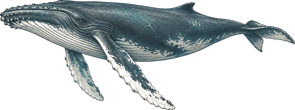
Banderas Bay, Marietas Islands
Seen from the boat on the way to Marietas or El Chimo; heard underwater.4
Common in season, from the surface.
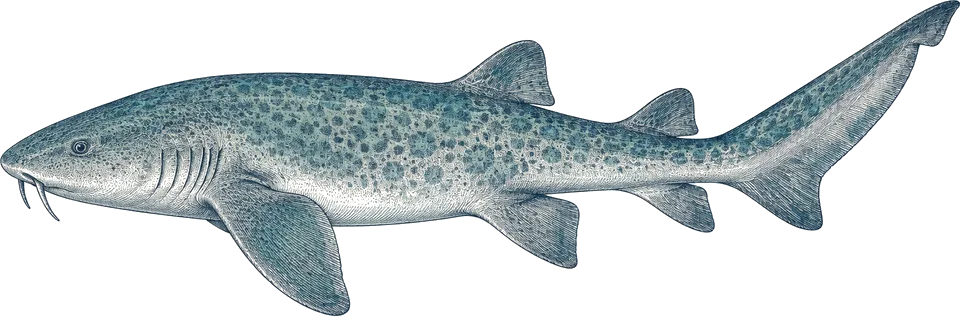
El Morro, Los Anegados, La Corbeteña
Look under ledges and in caves, where they rest by day.5
Often on offshore dives.
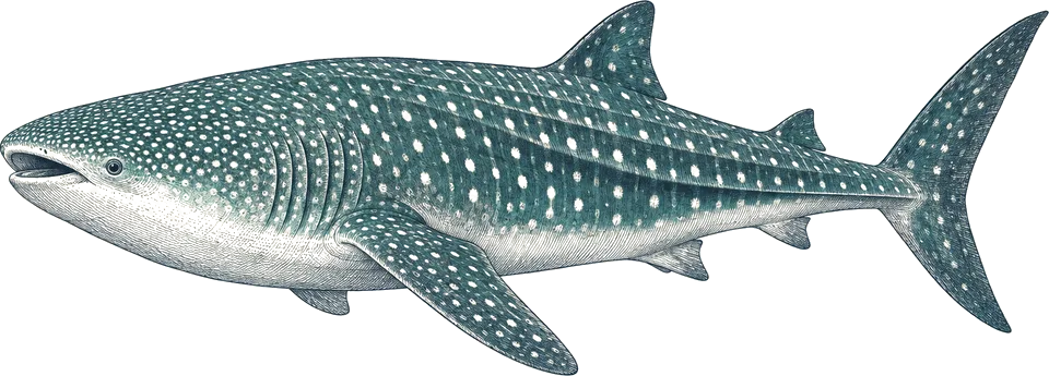
El Morro, El Chimo
Chance passing encounters on offshore pinnacles.1
Occasional; summer at El Chimo.
Compiled from the sources above, last checked 2026-11-11. Monthly conditions come from our own climate records; see how we score.