
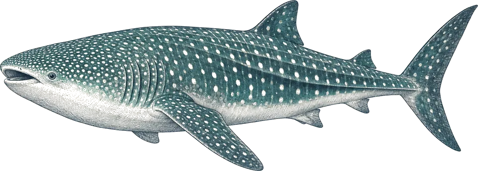
whale shark
All yearKwatisore Bay bagans
Hang or snorkel beside the bagan as sharks feed at the nets near the surface.5
Very high; often 5 to 7 per bagan.
The best time to dive Cenderawasih Bay is June to October, when most liveaboards run and the sea is calm. Whale sharks feed at the bagan fishing platforms in Kwatisore Bay all year, so the real question is when a boat goes. I'd book whichever June to October departure fits.
Operators say: Whale sharks are present all year; most liveaboards visit June to October, when Raja Ampat is rough and the bay is calm. Our data finds conditions even all year; DAN describes February to May as rainier and stormier.
111 km across · coastline from Natural Earth 10m
Cenderawasih Bay is known for one thing above all: whale sharks that feed beneath the bagans, floodlit fishing platforms in Kwatisore Bay at the park's southern end. The sharks suck baitfish from the nets and are hand-fed by the fishermen. WWF reported five to seven at one platform in 2011, and DAN counted 13 under a single bagan. Feeding peaks around mid-morning and late afternoon, in calm water near the surface.
The rest of a trip is reefs and history: soft-coral walls and drifts at Nusir and Tanjung Mangguar, macro at Roon and Purup, and Second World War wrecks around Manokwari and Biak, from fighter planes in the shallows to the Shinwa Maru at 34 m. The park covers about 14,500 km², and almost everyone visits on a 9- to 14-night liveaboard.
Conditions barely change across the year, so no month beats another — pick on wildlife or price.
Hover a month to isolate it.
| January | February | March | April | May | June | July | August | September | October | November | December | |
|---|---|---|---|---|---|---|---|---|---|---|---|---|
| Conditions | Even | Even | Even | Even | Even | Even | Even | Even | Even | Even | Even | Even |
| Water temp (°C) | 30 | 30 | 30 | 30 | 30 | 30 | 30 | 30 | 30 | 30 | 30 | 30 |
| Visibility (m) | 20–30 | 20–30 | 20–30 | 20–30 | 20–30 | 20–30 | 20–30 | 20–30 | 20–30 | 20–30 | 20–30 | 20–30 |
| Marine life | No data | No data | No data | No data | No data | No data | No data | No data | No data | No data | No data | No data |
Long-term averages, 2016–2025. Visibility is estimated from satellite chlorophyll-a. Water temperature is the surface mean; it is cooler at depth.
Diving conditionsSeas are usually flat. This is the wet season topside.
10 years of sea temperature
Dashed: monthly average. Band: eight days in ten.
10th to 90th percentile rangemonthly mean
Seas top 2.5 m on under 1% of days. Enough to cancel a liveaboard crossing
Gusts over 40 km/h, about where a day boat stays in port
9 of them bring heavy rain
| Month | Swell | Gusts over 40 km/h | Wet days | Heavy rain | Air | Daylight |
|---|---|---|---|---|---|---|
| Jan | 0.4 m | 0% | 25 | 8 | 29 °C | 12.1 h |
| Feb | 0.4 m | 0% | 22 | 8 | 29 °C | 12.1 h |
| Mar | 0.3 m | 0% | 24 | 10 | 29 °C | 12.0 h |
| Apr | 0.2 m | 0% | 25 | 10 | 29 °C | 11.9 h |
| May | 0.2 m | 0% | 27 | 9 | 29 °C | 11.9 h |
| Jun | 0.2 m | 0% | 26 | 10 | 29 °C | 11.9 h |
| Jul | 0.2 m | 0% | 24 | 8 | 29 °C | 11.9 h |
| Aug | 0.1 m | 0% | 25 | 8 | 29 °C | 11.9 h |
| Sep | 0.2 m | 0% | 25 | 9 | 29 °C | 12.0 h |
| Oct | 0.2 m | 0% | 25 | 8 | 30 °C | 12.1 h |
| Nov | 0.3 m | 0% | 23 | 8 | 30 °C | 12.1 h |
| Dec | 0.3 m | 0% | 24 | 8 | 30 °C | 12.1 h |
Swell is the rough end of the month: nine days in ten come in under it. Sea temperature covers 10 years, waves 4.
Darker is better, against this site's own year. Pick a month for its weeks.
| Week 1 | ||||||||||||
|---|---|---|---|---|---|---|---|---|---|---|---|---|
| Week 2 | ||||||||||||
| Week 3 | ||||||||||||
| Week 4 |
| Week | Conditions | Water | Swell | Wind | Rain chance |
|---|---|---|---|---|---|
| Week 1 | Moderate | 30 °C | 0.3 m | 17 km/h | 82% |
| Week 2 | Moderate | 30 °C | 0.3 m | 16 km/h | 81% |
| Week 3 | Moderate | 30 °C | 0.4 m | 17 km/h | 83% |
| Week 4 | Moderate | 30 °C | 0.4 m | 18 km/h | 78% |
| Week 1 | Moderate | 30 °C | 0.4 m | 18 km/h | 71% |
| Week 2 | Moderate | 30 °C | 0.4 m | 18 km/h | 71% |
| Week 3 | Moderate | 30 °C | 0.4 m | 18 km/h | 79% |
| Week 4 | Moderate | 30 °C | 0.3 m | 18 km/h | 86% |
| Week 1 | Moderate | 30 °C | 0.3 m | 17 km/h | 86% |
| Week 2 | Moderate | 30 °C | 0.4 m | 17 km/h | 79% |
| Week 3 | Moderate | 30 °C | 0.3 m | 17 km/h | 76% |
| Week 4 | Moderate | 30 °C | 0.3 m | 16 km/h | 77% |
| Week 1 | Moderate | 30 °C | 0.3 m | 16 km/h | 77% |
| Week 2 | Moderate | 30 °C | 0.2 m | 16 km/h | 81% |
| Week 3 | Moderate | 30 °C | 0.2 m | 16 km/h | 86% |
| Week 4 | Moderate | 30 °C | 0.2 m | 15 km/h | 88% |
| Week 1 | Moderate | 30 °C | 0.2 m | 15 km/h | 89% |
| Week 2 | Moderate | 30 °C | 0.2 m | 14 km/h | 90% |
| Week 3 | Moderate | 30 °C | 0.2 m | 14 km/h | 89% |
| Week 4 | Moderate | 30 °C | 0.2 m | 15 km/h | 85% |
| Week 1 | Moderate | 30 °C | 0.2 m | 15 km/h | 81% |
| Week 2 | Moderate | 30 °C | 0.2 m | 14 km/h | 86% |
| Week 3 | Moderate | 30 °C | 0.2 m | 14 km/h | 89% |
| Week 4 | Moderate | 30 °C | 0.2 m | 15 km/h | 89% |
| Week 1 | Moderate | 30 °C | 0.2 m | 15 km/h | 87% |
| Week 2 | Moderate | 30 °C | 0.2 m | 16 km/h | 80% |
| Week 3 | Moderate | 30 °C | 0.2 m | 16 km/h | 75% |
| Week 4 | Moderate | 30 °C | 0.2 m | 16 km/h | 71% |
| Week 1 | Moderate | 30 °C | 0.2 m | 16 km/h | 72% |
| Week 2 | Moderate | 30 °C | 0.1 m | 16 km/h | 80% |
| Week 3 | Moderate | 30 °C | 0.1 m | 16 km/h | 85% |
| Week 4 | Moderate | 30 °C | 0.2 m | 16 km/h | 85% |
| Week 1 | Moderate | 30 °C | 0.2 m | 16 km/h | 81% |
| Week 2 | Moderate | 30 °C | 0.2 m | 15 km/h | 80% |
| Week 3 | Moderate | 30 °C | 0.2 m | 16 km/h | 82% |
| Week 4 | Moderate | 30 °C | 0.2 m | 16 km/h | 86% |
| Week 1 | Moderate | 30 °C | 0.2 m | 15 km/h | 83% |
| Week 2 | Moderate | 30 °C | 0.2 m | 15 km/h | 81% |
| Week 3 | Moderate | 30 °C | 0.2 m | 15 km/h | 82% |
| Week 4 | Moderate | 30 °C | 0.2 m | 15 km/h | 77% |
| Week 1 | Moderate | 30 °C | 0.3 m | 15 km/h | 74% |
| Week 2 | Moderate | 30 °C | 0.3 m | 15 km/h | 76% |
| Week 3 | Moderate | 30 °C | 0.3 m | 15 km/h | 79% |
| Week 4 | Moderate | 30 °C | 0.3 m | 15 km/h | 79% |
| Week 1 | Moderate | 30 °C | 0.3 m | 16 km/h | 75% |
| Week 2 | Moderate | 30 °C | 0.3 m | 17 km/h | 73% |
| Week 3 | Moderate | 30 °C | 0.4 m | 17 km/h | 77% |
| Week 4 | Moderate | 30 °C | 0.4 m | 17 km/h | 82% |
10 years of daily records, averaged into weeks.
Sized for each month's coldest water.
| Jan | Feb | Mar | Apr | May | Jun | Jul | Aug | Sep | Oct | Nov | Dec | |
|---|---|---|---|---|---|---|---|---|---|---|---|---|
| Suit | skin | skin | skin | skin | skin | skin | skin | skin | skin | skin | skin | skin |
Suit row is for surface water. At depth: 3 mm wetsuit. SMB and torch; a wide lens for the whale sharks and a dive light for wreck interiors.
Each month's rough end: nine days in ten are calmer.
Amber is over 2.5 m.
No tropical storm has come within 250 km in 30 years of records. Swell and wind set the season, not cyclones.
Only 0 records have been logged within 60 km. A thin record is not an empty reef.
No survey records within 60 km of this site.
Logged sightings, not a full survey. How to read this table.
| Site | Depth | Level | What to expect |
|---|---|---|---|
| Kwatisore Bay baganswhale shark platform | ≈ 3–18 m | Open Water | Whale sharks feed at the nets under floodlit fishing platforms, often near the surface, in mild current. Best mid-morning and late afternoon. This is the reason to come.3 |
| Shinwa Maruwreck | 16–34 m | Experienced | WWII Japanese cargo ship of about 120 m on its side off Manokwari, cargo of dishes and sake bottles. Deep enough that I'd want nitrox and experience.1 |
| Cross Wreckwreck | ≈ 10–20 m | Advanced | WWII wreck at about 20 m in the Manokwari group.4 |
| Pasir Putih patrol boatwreck | 14–40 m | Experienced | WWII patrol boat off Manokwari, 14 to 40 m; for experienced wreck divers.4 |
| Flying Catalinawreck | 19–30 m | Advanced | PBY Catalina flying boat wreck off Biak at 19 to 30 m.1 |
| Pulau Rouw aircraft wreckswreck | 1–12 m | Open Water | WWII fighter wrecks in the shallows off Rouw in the Auri Islands; good for snorkellers too.4 |
| Pulau Roonslope / channel | ≈ 5–25 m | Open Water | Sloping walls, coral gardens, a Japanese Zero wreck and a sheltered channel for relaxed drifts and macro.1 |
| Pulau Nusirwall / drift | ≈ 5–30 m | Experienced | Drop-offs and coral walls in strong current with fusiliers, reef sharks and pelagics.4 |
| Tanjung Mangguarwall / plateau | ≈ 5–30 m | Advanced | Soft and whip coral wall on one side, hard coral plateau on the other; manta and mobula cleaning station in strong current.1 |
| Pulau Purupslope | ≈ 5–25 m | Open Water | Sheltered slope with flasher wrasses and macro; blacktip reef sharks and eagle rays.1 |
Kwatisore Bay bagans
Hang or snorkel beside the bagan as sharks feed at the nets near the surface.5
Very high; often 5 to 7 per bagan.
Tanjung Mangguar
Settle beside the cleaning station in the current and wait.1
Possible; months are when trips run.
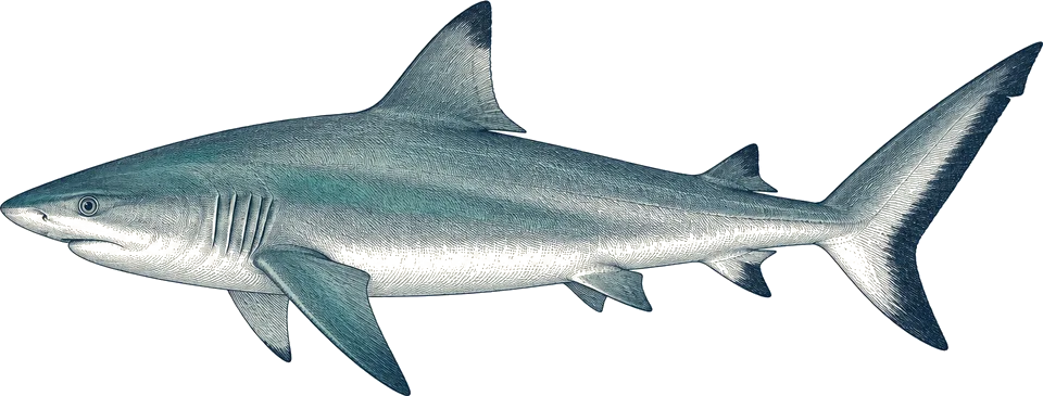
Pulau Nusir, Tanjung Mangguar
Watch the reef edge and drop-offs on drift dives.4
Regular on the current-swept sites.
Compiled from the sources above, last checked 2026-11-12. Monthly conditions come from our own climate records; see how we score.