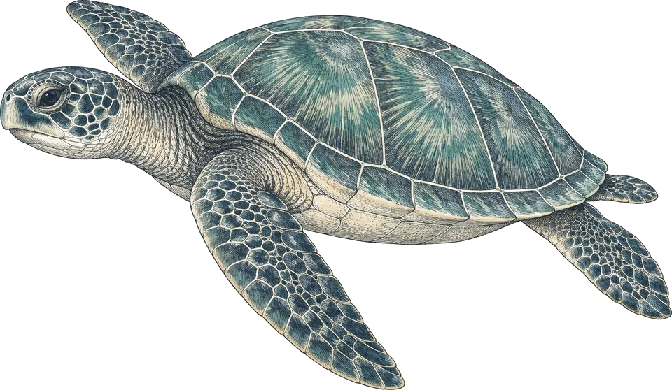
green and hawksbill turtles
All yearKatipanan, Chapel, Largahan, Rock Point
Slow along the shallows at 3 to 10 m; they rest under overhangs and feed on the reef top.1
Very high; often several per dive.
The best time to dive Apo Island is March to May: the driest months and warm water. The crossing from Dauin is roughest January to March, and typhoon season starts in June. I'd go in April or May.
Operators say: March to May. Operators dive Apo all year when the sea allows and rate the far points best April to November. Our data scores rain, so it marks June down and rates July to December poorly.

By Eugen. Based on 12 sources, checked 12 November 2026.
111 km across · coastline from Natural Earth 10m
Apo Island is a small volcanic island about 30 km south of Dumaguete. Its community set aside a no-take sanctuary in 1982, and in 1994 the island and about 691 hectares of sea around it became a Protected Landscape and Seascape. Decades of protection show in the hard coral cover and in the green and hawksbill turtles that feed in the shallows on almost every dive.
Most divers visit on a three-dive day trip from Dauin, 30 to 45 minutes away by outrigger. Sheltered slopes such as Katipanan, Chapel and Largahan suit new divers. Coconut Point and Mamsa Point are drift dives with strong and sometimes downward currents, for experienced divers only. The crossing is roughest from January to March, when the north-east monsoon blows.
Hover a month to isolate it.
| January | February | March | April | May | June | July | August | September | October | November | December | |
|---|---|---|---|---|---|---|---|---|---|---|---|---|
| Conditions | Moderate | Good | Excellent | Excellent | Excellent | Moderate | Poor | Moderate | Poor | Poor | Poor | Poor |
| Water temp (°C) | 28 | 27 | 28 | 28 | 29 | 30 | 29 | 29 | 29 | 30 | 29 | 29 |
| Visibility (m) | 15–25 | 15–25 | 15–25 | 20–30 | 20–30 | 20–30 | 20–30 | 20–30 | 20–30 | 20–30 | 20–30 | 20–30 |
| Marine life | Peak | Peak | Peak | Peak | Peak | Peak | Peak | Peak | Peak | Peak | Peak | Peak |
| Best time | Peak | Peak | Peak |
Long-term averages, 2016–2025. Visibility is estimated from satellite chlorophyll-a. Water temperature is the surface mean; it is cooler at depth.
Diving conditionsRain is frequent topside. The wind is up. The sea is rougher.
Diving conditionsIt rains less. The wind is up.
Diving conditionsThe wind eases. It rains more.
Diving conditionsThe wind eases. It rains more.
Marine lifeWhale shark (hit-or-miss) peaks at Apo Island in these months.
369 underwater observation records · 18 surveyed years of ocean data · 10 years of sea temperature
Dashed: monthly average. Band: eight days in ten.
10th to 90th percentile rangemonthly mean
Seas top 1.5 m on 3% of days. Enough to cancel a day boat
Gusts over 40 km/h, about where a day boat stays in port
5 of them bring heavy rain
| Month | Swell | Gusts over 40 km/h | Wet days | Heavy rain | Air | Daylight |
|---|---|---|---|---|---|---|
| Jan | 1.3 m | 0% | 16 | 4 | 29 °C | 11.5 h |
| Feb | 1.3 m | 0% | 12 | 2 | 29 °C | 11.7 h |
| Mar | 1.1 m | 0% | 10 | 1 | 30 °C | 11.9 h |
| Apr | 0.9 m | 0% | 11 | 2 | 31 °C | 12.2 h |
| May | 0.8 m | 0% | 20 | 4 | 31 °C | 12.4 h |
| Jun | 0.7 m | 0% | 24 | 8 | 30 °C | 12.5 h |
| Jul | 1.3 m | 0% | 24 | 8 | 30 °C | 12.5 h |
| Aug | 1.0 m | 0% | 22 | 7 | 30 °C | 12.3 h |
| Sep | 1.4 m | 0% | 23 | 9 | 30 °C | 12.0 h |
| Oct | 1.2 m | 0% | 26 | 11 | 30 °C | 11.8 h |
| Nov | 1.1 m | 0% | 23 | 5 | 30 °C | 11.6 h |
| Dec | 1.0 m | 0% | 22 | 4 | 29 °C | 11.5 h |
Swell is the rough end of the month: nine days in ten come in under it. Sea temperature covers 10 years, waves 4.
Darker is better, against this site's own year. Pick a month for its weeks.
| Week 1 | ||||||||||||
|---|---|---|---|---|---|---|---|---|---|---|---|---|
| Week 2 | ||||||||||||
| Week 3 | ||||||||||||
| Week 4 |
| Week | Conditions | Water | Swell | Wind | Rain chance |
|---|---|---|---|---|---|
| Week 1 | Good | 28 °C | 1.2 m | 23 km/h | 60% |
| Week 2 | Moderate | 28 °C | 1.3 m | 23 km/h | 53% |
| Week 3 | Moderate | 28 °C | 1.3 m | 23 km/h | 51% |
| Week 4 | Moderate | 27 °C | 1.2 m | 24 km/h | 49% |
| Week 1 | Moderate | 27 °C | 1.2 m | 24 km/h | 47% |
| Week 2 | Moderate | 27 °C | 1.2 m | 25 km/h | 44% |
| Week 3 | Good | 27 °C | 1.3 m | 25 km/h | 38% |
| Week 4 | Excellent | 27 °C | 1.3 m | 26 km/h | 31% |
| Week 1 | Good | 27 °C | 1.3 m | 24 km/h | 30% |
| Week 2 | Excellent | 27 °C | 1.1 m | 23 km/h | 32% |
| Week 3 | Excellent | 28 °C | 1.0 m | 23 km/h | 29% |
| Week 4 | Excellent | 28 °C | 1.0 m | 23 km/h | 33% |
| Week 1 | Good | 28 °C | 0.9 m | 22 km/h | 39% |
| Week 2 | Excellent | 28 °C | 1.0 m | 20 km/h | 35% |
| Week 3 | Excellent | 28 °C | 0.9 m | 20 km/h | 31% |
| Week 4 | Excellent | 29 °C | 0.9 m | 20 km/h | 39% |
| Week 1 | Good | 29 °C | 0.9 m | 19 km/h | 49% |
| Week 2 | Good | 29 °C | 0.8 m | 17 km/h | 58% |
| Week 3 | Excellent | 29 °C | 0.6 m | 15 km/h | 68% |
| Week 4 | Excellent | 30 °C | 0.8 m | 14 km/h | 72% |
| Week 1 | Poor | 30 °C | 1.0 m | 14 km/h | 77% |
| Week 2 | Poor | 30 °C | 1.0 m | 14 km/h | 75% |
| Week 3 | Good | 30 °C | 0.6 m | 13 km/h | 74% |
| Week 4 | Good | 30 °C | 0.6 m | 14 km/h | 81% |
| Week 1 | Moderate | 30 °C | 0.9 m | 14 km/h | 80% |
| Week 2 | Poor | 29 °C | 1.4 m | 15 km/h | 84% |
| Week 3 | Poor | 29 °C | 1.6 m | 16 km/h | 85% |
| Week 4 | Poor | 29 °C | 1.3 m | 19 km/h | 68% |
| Week 1 | Moderate | 29 °C | 0.9 m | 19 km/h | 63% |
| Week 2 | Good | 29 °C | 0.8 m | 17 km/h | 71% |
| Week 3 | Good | 29 °C | 0.9 m | 16 km/h | 74% |
| Week 4 | Poor | 29 °C | 1.4 m | 16 km/h | 74% |
| Week 1 | Moderate | 30 °C | 1.3 m | 16 km/h | 75% |
| Week 2 | Poor | 29 °C | 1.5 m | 16 km/h | 80% |
| Week 3 | Poor | 29 °C | 1.7 m | 16 km/h | 74% |
| Week 4 | Moderate | 29 °C | 1.2 m | 15 km/h | 72% |
| Week 1 | Moderate | 30 °C | 1.0 m | 14 km/h | 79% |
| Week 2 | Moderate | 30 °C | 1.0 m | 14 km/h | 84% |
| Week 3 | Poor | 30 °C | 1.4 m | 15 km/h | 85% |
| Week 4 | Poor | 30 °C | 2.1 m | 15 km/h | 85% |
| Week 1 | Poor | 29 °C | 1.4 m | 17 km/h | 82% |
| Week 2 | Poor | 29 °C | 1.1 m | 19 km/h | 74% |
| Week 3 | Poor | 29 °C | 1.1 m | 20 km/h | 72% |
| Week 4 | Poor | 29 °C | 1.1 m | 22 km/h | 73% |
| Week 1 | Poor | 29 °C | 1.1 m | 21 km/h | 72% |
| Week 2 | Poor | 29 °C | 1.0 m | 20 km/h | 73% |
| Week 3 | Poor | 29 °C | 1.0 m | 22 km/h | 72% |
| Week 4 | Poor | 28 °C | 1.1 m | 22 km/h | 71% |
10 years of daily records, averaged into weeks.
Sized for each month's coldest water.
| Jan | Feb | Mar | Apr | May | Jun | Jul | Aug | Sep | Oct | Nov | Dec | |
|---|---|---|---|---|---|---|---|---|---|---|---|---|
| Suit | 3 mm | 3 mm | 3 mm | skin | skin | skin | skin | skin | skin | skin | skin | skin |
Suit row is for surface water. At depth: 3 mm wetsuit most of the year; 5 mm from late December to March, when the water drops to 25 to 26 °C. SMB for the drift sites.
Each month's rough end: nine days in ten are calmer.
Amber is over 1.5 m.
6 of the last 30 Novembers saw a tropical storm pass within 250 km. Anything has been recorded Nov–Mar, Jun.
Share of the last 30 years with a storm that month.
| Species | When | Observed window | Reliability | Evidence | Records |
|---|---|---|---|---|---|
| Whale shark | All year | Hit-or-miss | 107 | ||
| Green turtle | All year | Near-guaranteed | 167 | ||
| Hawksbill turtle | All year | Near-guaranteed | 41 | ||
| Bigeye trevally | Mar, Jun, Oct–Nov | Likely | 18 |
Logged sightings, not a full survey. How to read this table.
| Site | Depth | Level | What to expect |
|---|---|---|---|
| Coconut Pointdrift / wall | 5–30 m | Experienced | Drift along a wall into the blue at about 30 m with jacks and barracuda. Strong, shifting down-currents; nicknamed the Washing Machine. I'd leave it for later.3 |
| Chapelwall | 5–30 m | Open Water | Below the island's church: shallow coral, then a holey wall with overhangs and small caverns. Sea kraits, snappers and turtles on the way back.2 |
| Rock Point Eastslope | 5–30 m | Advanced | Southern tip of the island: soft corals, Spanish mackerel, sometimes sharks. Current can be strong, so guides take a conservative route on rough days.3 |
| Rock Point Westslope | 6–30 m | Advanced | Hard coral with pyramid butterflyfish, frogfish, cuttlefish and banded sea kraits; mobulas and mantas are occasional.2 |
| Katipananslope | 5–20 m | Open Water | Gentle coral slope with many turtles in the shallows. Used for newer divers; the best reef is above 18 m. The one I'd start on.3 |
| Mamsa Pointdrift | 6–25 m | Experienced | Sandy arena ringed by coral where jacks school and giant trevally hunt; giant frogfish. Strong current and downwelling; best April to November.3 |
| Largahanslope / wall | 3–20 m | Open Water | Volcanic sand with geothermal bubbles rising from the seabed, a hawksbill at turtle rock, and little current.1 |
| Cogondrift | 8–20 m | Advanced | Eastern side: drift from sand onto table and staghorn coral; pygmy seahorses below 20 m. Often linked with Mamsa and Kan-uran.1 |
| Boluarteslope | 5–30 m | Open Water | Named for a large solitary rock; plate and mushroom coral plateau, small wall, bubbles from the sand and turtles.8 |
| Kan-uranwall | 5–20 m | Open Water | Wall with sandy ledges, sea fans and soft corals; nudibranchs and filefish. Often the end of the Cogon drift.1 |
Katipanan, Chapel, Largahan, Rock Point
Slow along the shallows at 3 to 10 m; they rest under overhangs and feed on the reef top.1
Very high; often several per dive.
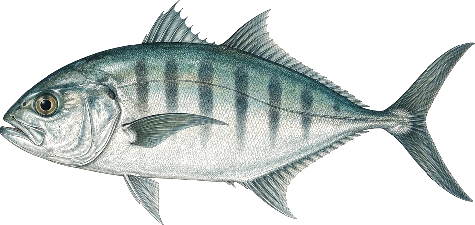
Mamsa Point, Coconut Point
Drift with the guide and wait at the edge of the sandy arena as the school passes.3
Regular when the current is running.
Chapel, Rock Point East, Rock Point West
Watch them hunting through coral heads; harmless if left alone.2
Common; seasonal peaks reported, not dated.
Compiled from the sources above, last checked 2026-11-12. Monthly conditions come from our own climate records; see how we score.