
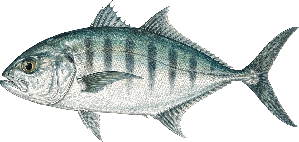
bigeye trevally
All yearB24 Liberator wreck
Hover off the wreck at 16 to 24 m as the school circles.1
A large resident school.
The best time to dive the Togean Islands is May to October, the dry season, when seas are calm and visibility reaches 20 to 40 m. Operators call June to August clearest; our rain data favours August and September. August is where I'd aim.
Operators say: May to October, the dry season; June to August often clearest. Our data, mostly driven by rain, rates August and September best and May and July poor. It shows flat seas all year.
111 km across · coastline from Natural Earth 10m
The Togean (Togian) Islands sit in the Gulf of Tomini, in the middle of Sulawesi, and have been a national park since 2004. The gulf shelters them, so most diving is calm: fringing and barrier reefs around Kadidiri and Walea, the Pasir Tengah atoll with walls dropping hundreds of metres, a US B-24 Liberator bomber at about 18 to 24 m, and deeper walls and pinnacles around the volcanic island of Una Una. Batu Gila, outside the barrier reef, is the main current dive.
Water stays 27 to 30 °C all year. Operators rate May to October best, with June to August often clearest at 20 to 40 m, and some describe March to December as the dry season. Our climate data, which weighs rain heavily, rates August and September best. The wet north-west monsoon, about November to April, cuts visibility to 10 to 18 m, and some operators close in January and February. Access is slow: no airport, so divers take ferries from Ampana or Gorontalo, or join a liveaboard from Manado.
Hover a month to isolate it.
| January | February | March | April | May | June | July | August | September | October | November | December | |
|---|---|---|---|---|---|---|---|---|---|---|---|---|
| Conditions | Poor | Good | Good | Moderate | Poor | Moderate | Poor | Excellent | Excellent | Good | Good | Good |
| Water temp (°C) | 30 | 30 | 30 | 31 | 31 | 30 | 30 | 30 | 30 | 31 | 30 | 30 |
| Visibility (m) | 20–30 | 20–30 | 20–30 | 20–30 | 20–30 | 20–30 | 20–30 | 20–30 | 20–30 | 20–30 | 20–30 | 20–30 |
| Marine life | Quiet | Peak | Peak | Busy | Quiet | Busy | Quiet | Peak | Busy | Busy | Busy | Busy |
| Best time | Peak | Peak | Peak | Peak | Peak | Peak |
Long-term averages, 2016–2025. Visibility is estimated from satellite chlorophyll-a. Water temperature is the surface mean; it is cooler at depth.
Diving conditionsSeas are usually flat. This is the wet season topside.
Diving conditionsSeas are usually flat. This is the wet season topside.
Diving conditionsSeas are usually flat. This is the wet season topside.
Diving conditionsSeas are usually flat. This is the wet season topside.
Marine lifeGolden jellyfish (near-guaranteed) peaks at Togean Islands in these months.
47 underwater observation records · 10 surveyed years of ocean data · 10 years of sea temperature
Dashed: monthly average. Band: eight days in ten.
10th to 90th percentile rangemonthly mean
Seas top 1.5 m on under 1% of days. Enough to cancel a day boat
Gusts over 40 km/h, about where a day boat stays in port
12 of them bring heavy rain
| Month | Swell | Gusts over 40 km/h | Wet days | Heavy rain | Air | Daylight |
|---|---|---|---|---|---|---|
| Jan | 0.3 m | 0% | 27 | 12 | 30 °C | 12.0 h |
| Feb | 0.3 m | 0% | 26 | 12 | 30 °C | 12.0 h |
| Mar | 0.3 m | 0% | 29 | 13 | 30 °C | 12.0 h |
| Apr | 0.2 m | 0% | 29 | 17 | 30 °C | 12.0 h |
| May | 0.1 m | 0% | 30 | 17 | 30 °C | 12.0 h |
| Jun | 0.1 m | 0% | 27 | 16 | 30 °C | 12.0 h |
| Jul | 0.2 m | 0% | 23 | 11 | 30 °C | 12.0 h |
| Aug | 0.3 m | 0% | 21 | 7 | 30 °C | 12.0 h |
| Sep | 0.3 m | 0% | 19 | 7 | 31 °C | 12.0 h |
| Oct | 0.2 m | 0% | 26 | 10 | 31 °C | 12.0 h |
| Nov | 0.2 m | 0% | 28 | 12 | 31 °C | 12.0 h |
| Dec | 0.3 m | 0% | 28 | 11 | 30 °C | 12.0 h |
Swell is the rough end of the month: nine days in ten come in under it. Sea temperature covers 10 years, waves 4.
Darker is better, against this site's own year. Pick a month for its weeks.
| Week 1 | ||||||||||||
|---|---|---|---|---|---|---|---|---|---|---|---|---|
| Week 2 | ||||||||||||
| Week 3 | ||||||||||||
| Week 4 |
| Week | Conditions | Water | Swell | Wind | Rain chance |
|---|---|---|---|---|---|
| Week 1 | Poor | 30 °C | 0.3 m | 8 km/h | 86% |
| Week 2 | Poor | 30 °C | 0.3 m | 9 km/h | 85% |
| Week 3 | Poor | 30 °C | 0.3 m | 9 km/h | 85% |
| Week 4 | Moderate | 30 °C | 0.3 m | 10 km/h | 89% |
| Week 1 | Good | 30 °C | 0.2 m | 9 km/h | 91% |
| Week 2 | Good | 30 °C | 0.3 m | 9 km/h | 86% |
| Week 3 | Good | 30 °C | 0.4 m | 9 km/h | 88% |
| Week 4 | Moderate | 30 °C | 0.3 m | 9 km/h | 92% |
| Week 1 | Good | 30 °C | 0.3 m | 9 km/h | 93% |
| Week 2 | Good | 30 °C | 0.3 m | 9 km/h | 92% |
| Week 3 | Good | 30 °C | 0.2 m | 9 km/h | 92% |
| Week 4 | Good | 30 °C | 0.2 m | 9 km/h | 94% |
| Week 1 | Moderate | 30 °C | 0.2 m | 9 km/h | 95% |
| Week 2 | Moderate | 31 °C | 0.2 m | 8 km/h | 95% |
| Week 3 | Moderate | 31 °C | 0.2 m | 8 km/h | 96% |
| Week 4 | Moderate | 31 °C | 0.2 m | 8 km/h | 96% |
| Week 1 | Moderate | 31 °C | 0.1 m | 8 km/h | 97% |
| Week 2 | Moderate | 31 °C | 0.1 m | 8 km/h | 98% |
| Week 3 | Moderate | 31 °C | 0.1 m | 8 km/h | 99% |
| Week 4 | Moderate | 31 °C | 0.2 m | 8 km/h | 95% |
| Week 1 | Moderate | 31 °C | 0.2 m | 8 km/h | 88% |
| Week 2 | Moderate | 30 °C | 0.1 m | 8 km/h | 89% |
| Week 3 | Moderate | 30 °C | 0.1 m | 8 km/h | 93% |
| Week 4 | Moderate | 30 °C | 0.1 m | 8 km/h | 94% |
| Week 1 | Moderate | 30 °C | 0.1 m | 9 km/h | 89% |
| Week 2 | Moderate | 30 °C | 0.2 m | 9 km/h | 78% |
| Week 3 | Poor | 30 °C | 0.3 m | 11 km/h | 68% |
| Week 4 | Moderate | 30 °C | 0.2 m | 11 km/h | 69% |
| Week 1 | Excellent | 30 °C | 0.2 m | 11 km/h | 70% |
| Week 2 | Excellent | 30 °C | 0.3 m | 11 km/h | 66% |
| Week 3 | Excellent | 30 °C | 0.3 m | 11 km/h | 66% |
| Week 4 | Excellent | 30 °C | 0.4 m | 11 km/h | 68% |
| Week 1 | Excellent | 30 °C | 0.4 m | 10 km/h | 64% |
| Week 2 | Excellent | 30 °C | 0.3 m | 10 km/h | 62% |
| Week 3 | Excellent | 30 °C | 0.3 m | 10 km/h | 61% |
| Week 4 | Excellent | 30 °C | 0.3 m | 10 km/h | 65% |
| Week 1 | Moderate | 30 °C | 0.3 m | 9 km/h | 74% |
| Week 2 | Good | 30 °C | 0.2 m | 9 km/h | 81% |
| Week 3 | Good | 31 °C | 0.2 m | 9 km/h | 86% |
| Week 4 | Good | 31 °C | 0.2 m | 9 km/h | 87% |
| Week 1 | Good | 31 °C | 0.2 m | 8 km/h | 89% |
| Week 2 | Good | 31 °C | 0.2 m | 8 km/h | 94% |
| Week 3 | Good | 30 °C | 0.3 m | 8 km/h | 97% |
| Week 4 | Good | 30 °C | 0.2 m | 9 km/h | 94% |
| Week 1 | Good | 30 °C | 0.2 m | 9 km/h | 92% |
| Week 2 | Moderate | 30 °C | 0.3 m | 9 km/h | 92% |
| Week 3 | Moderate | 30 °C | 0.3 m | 10 km/h | 89% |
| Week 4 | Good | 30 °C | 0.3 m | 10 km/h | 88% |
10 years of daily records, averaged into weeks.
Sized for each month's coldest water.
| Jan | Feb | Mar | Apr | May | Jun | Jul | Aug | Sep | Oct | Nov | Dec | |
|---|---|---|---|---|---|---|---|---|---|---|---|---|
| Suit | skin | skin | skin | skin | skin | skin | skin | skin | skin | skin | skin | skin |
Suit row is for surface water. At depth: 3 mm shorty or full suit. SMB and a torch. Bring spares, as the islands are remote and have few dive facilities.
Each month's rough end: nine days in ten are calmer.
Amber is over 1.5 m.
No tropical storm has come within 250 km in 30 years of records. Swell and wind set the season, not cyclones.
Only 47 records have been logged within 60 km. A thin record is not an empty reef.
| Species | When | Observed window | Reliability | Evidence | Records |
|---|---|---|---|---|---|
| Blacktip reef shark | Jun | Likely | 9 | ||
| Golden jellyfish | Feb–Mar, Aug | Near-guaranteed | 12 | ||
| Bluespotted ribbontail ray | Jun, Nov | Likely | 9 |
Logged sightings, not a full survey. How to read this table.
| Site | Depth | Level | What to expect |
|---|---|---|---|
| B24 Liberator wreckwreck | 16–24 m | Advanced | WWII US bomber ditched in 1945, upright and nearly intact on sand. A school of bigeye trevally circles it. Honestly, it's the dive I'd build the trip around.4 |
| Taipi Wallwall | ≈ 5–25 m | Open Water | Fairly easy wall with overhangs, cracks, sea fans and bumphead parrotfish; shallow coral garden on top for the safety stop.1 |
| Pasir Tengahatoll wall | ≈ 3–30 m | Advanced | 3 km atoll with near-vertical walls to great depth. Swim-through at about 12 m, nudibranchs at 3 to 6 m, eagle rays offshore.3 |
| Batu Gilaridge / pinnacle | 27–42 m | Experienced | Ridge outside the barrier reef, top at 27 m. Strong currents at some tides; sharks, barracuda, sometimes hammerheads and mantas. Not one for me yet.3 |
| Apollo (Una Una)patch reef | 21–40 m | Experienced | Patch reef on a sandy slope off south-east Una Una, 21 to 45 m. Huge schools of blacktail barracuda, Napoleon wrasse, morays.1 |
| The Pinnacle (Una Una)pinnacle | ≈ 27–40 m | Experienced | Pinnacle rising from over 200 m to about 27 m, east walls to 60 m. Tuna, whitetip and grey reef sharks, turtles.3 |
| Dominic Rockwall | ≈ 10–40 m | Experienced | Rock with a drop-off past 40 m on the north side: soft corals, gorgonians, black frogfish, groupers, eagle rays.1 |
| Walea House Reefhouse reef | 2–20 m | Open Water | Shore dive from the Walea Bahi resort jetty. Ghost pipefish at 15 to 18 m, pygmy seahorses at 12 to 16 m, mandarinfish at dusk.1 |
B24 Liberator wreck
Hover off the wreck at 16 to 24 m as the school circles.1
A large resident school.
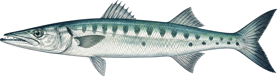
Apollo (Una Una)
Deep dive at 21 m and below on the sandy slope.1
Huge schools reported.
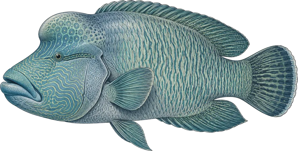
Apollo (Una Una)
Look along the reef and slope at 20 m and below.4
Regular at Apollo.
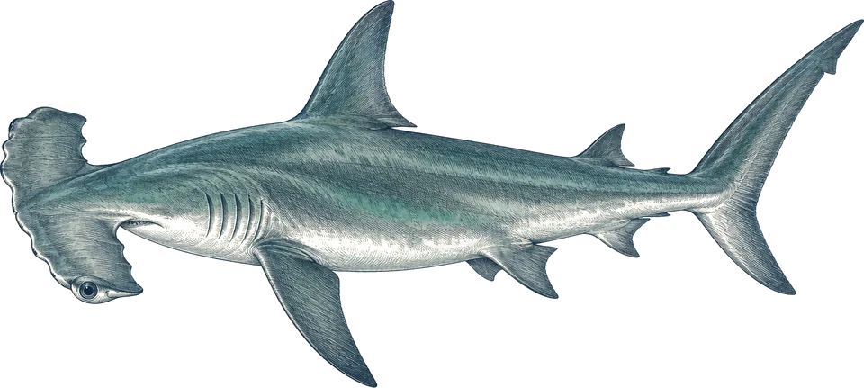
Batu Gila
Watch the blue off the ridge in current, below 27 m.3
Occasional; not reliable.
Compiled from the sources above, last checked 2026-11-12. Monthly conditions come from our own climate records; see how we score.