
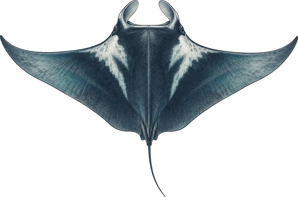
manta ray
Feb–MayBlack Rock, Tower Rock, western open-water sites
Watch the blue off exposed rocks and pinnacles at mid-depth.3
Possible; most likely February to May.
The best time to dive the Mergui Archipelago is December to April, the dry north-east monsoon, when liveaboards from Ranong run. Mantas and whale sharks are most likely from February. I'd book March or April, after checking current travel advice for Myanmar.
Operators say: December to April; some boats start in November, and mantas and whale sharks peak from February to May.
111 km across · coastline from Natural Earth 10m
The Mergui Archipelago is liveaboard-only diving across remote limestone islets and offshore banks in southern Myanmar. Inshore sites such as High Rock, Western Rocky and Shark Cave combine walls, swim-throughs and caves with shoals of snapper and trevally, nurse sharks resting in caves, and macro life such as harlequin shrimp, frogfish and seahorses. Further west, the Burma Banks are submerged pinnacles rising from more than 300 m to about 15 m, known for silvertip and other sharks, though reports say there are fewer large sharks than in the 1990s.
Trips sail from Ranong in Thailand and clear Myanmar immigration at Kawthaung. Boats run from about November to April, and December to April is the most reliable window; manta rays and whale sharks are most likely from February to May. From May to October the south-west monsoon brings rain and rough seas, and diving generally stops. Currents and plankton can cut visibility, so most boats ask for Advanced certification and 30 to 50 logged dives.
Hover a month to isolate it.
| January | February | March | April | May | June | July | August | September | October | November | December | |
|---|---|---|---|---|---|---|---|---|---|---|---|---|
| Conditions | Excellent | Excellent | Excellent | Excellent | Moderate | Poor | Poor | Poor | Poor | Moderate | Good | Excellent |
| Water temp (°C) | 28 | 28 | 29 | 30 | 30 | 30 | 29 | 29 | 29 | 29 | 29 | 28 |
| Visibility (m) | 10–20 | 10–20 | 10–20 | 10–20 | 10–20 | 10–20 | 10–20 | 10–20 | 10–20 | 10–20 | 10–20 | 10–20 |
| Marine life | No data | No data | No data | No data | No data | No data | No data | No data | No data | No data | No data | No data |
| Best time | Peak | Peak | Peak | Peak | Peak |
Long-term averages, 2016–2025. Visibility is estimated from satellite chlorophyll-a. Water temperature is the surface mean; it is cooler at depth.
Diving conditionsIt rains more. The sea is rougher.
Diving conditionsThis is the wet season topside. The sea is rougher. The wind is up.
Diving conditionsThis is the wet season topside. The sea is calmer. The wind eases.
Diving conditionsThe sea is calmer. The wind eases.
10 years of sea temperature
Dashed: monthly average. Band: eight days in ten.
10th to 90th percentile rangemonthly mean
Seas top 2.5 m on under 1% of days. Enough to cancel a liveaboard crossing
Gusts over 40 km/h, about where a day boat stays in port
8 of them bring heavy rain
| Month | Swell | Gusts over 40 km/h | Wet days | Heavy rain | Air | Daylight |
|---|---|---|---|---|---|---|
| Jan | 0.6 m | 1% | 5 | 1 | 28 °C | 11.4 h |
| Feb | 0.5 m | 0% | 6 | 0 | 29 °C | 11.6 h |
| Mar | 0.4 m | 1% | 6 | 1 | 29 °C | 11.9 h |
| Apr | 0.5 m | 0% | 12 | 2 | 30 °C | 12.3 h |
| May | 1.2 m | 2% | 22 | 10 | 30 °C | 12.5 h |
| Jun | 1.3 m | 5% | 26 | 16 | 29 °C | 12.7 h |
| Jul | 1.4 m | 10% | 28 | 16 | 29 °C | 12.6 h |
| Aug | 1.3 m | 8% | 29 | 17 | 28 °C | 12.4 h |
| Sep | 1.4 m | 6% | 27 | 16 | 28 °C | 12.1 h |
| Oct | 0.8 m | 1% | 27 | 11 | 28 °C | 11.7 h |
| Nov | 0.7 m | 0% | 13 | 4 | 29 °C | 11.5 h |
| Dec | 0.7 m | 0% | 5 | 1 | 29 °C | 11.3 h |
Swell is the rough end of the month: nine days in ten come in under it. Sea temperature covers 10 years, waves 4.
Darker is better, against this site's own year. Pick a month for its weeks.
| Week 1 | ||||||||||||
|---|---|---|---|---|---|---|---|---|---|---|---|---|
| Week 2 | ||||||||||||
| Week 3 | ||||||||||||
| Week 4 |
| Week | Conditions | Water | Swell | Wind | Rain chance |
|---|---|---|---|---|---|
| Week 1 | Excellent | 28 °C | 0.5 m | 22 km/h | 14% |
| Week 2 | Excellent | 28 °C | 0.5 m | 21 km/h | 18% |
| Week 3 | Excellent | 28 °C | 0.6 m | 21 km/h | 17% |
| Week 4 | Excellent | 28 °C | 0.6 m | 21 km/h | 16% |
| Week 1 | Excellent | 28 °C | 0.5 m | 21 km/h | 17% |
| Week 2 | Excellent | 28 °C | 0.5 m | 21 km/h | 20% |
| Week 3 | Excellent | 28 °C | 0.6 m | 22 km/h | 24% |
| Week 4 | Excellent | 29 °C | 0.6 m | 21 km/h | 21% |
| Week 1 | Excellent | 29 °C | 0.5 m | 20 km/h | 15% |
| Week 2 | Excellent | 29 °C | 0.4 m | 19 km/h | 19% |
| Week 3 | Excellent | 29 °C | 0.5 m | 20 km/h | 21% |
| Week 4 | Excellent | 30 °C | 0.5 m | 19 km/h | 27% |
| Week 1 | Excellent | 30 °C | 0.5 m | 18 km/h | 36% |
| Week 2 | Excellent | 30 °C | 0.5 m | 18 km/h | 37% |
| Week 3 | Excellent | 30 °C | 0.5 m | 18 km/h | 34% |
| Week 4 | Excellent | 30 °C | 0.5 m | 18 km/h | 43% |
| Week 1 | Good | 31 °C | 0.7 m | 18 km/h | 55% |
| Week 2 | Moderate | 31 °C | 0.9 m | 20 km/h | 63% |
| Week 3 | Moderate | 30 °C | 1.3 m | 23 km/h | 78% |
| Week 4 | Poor | 30 °C | 1.4 m | 26 km/h | 86% |
| Week 1 | Poor | 30 °C | 1.4 m | 29 km/h | 85% |
| Week 2 | Poor | 30 °C | 1.3 m | 30 km/h | 83% |
| Week 3 | Poor | 30 °C | 1.3 m | 28 km/h | 83% |
| Week 4 | Poor | 29 °C | 1.2 m | 27 km/h | 89% |
| Week 1 | Poor | 29 °C | 1.2 m | 28 km/h | 93% |
| Week 2 | Poor | 29 °C | 1.3 m | 29 km/h | 92% |
| Week 3 | Poor | 29 °C | 1.7 m | 31 km/h | 91% |
| Week 4 | Poor | 29 °C | 1.8 m | 33 km/h | 91% |
| Week 1 | Poor | 29 °C | 1.5 m | 32 km/h | 94% |
| Week 2 | Poor | 29 °C | 1.4 m | 30 km/h | 93% |
| Week 3 | Poor | 29 °C | 1.3 m | 29 km/h | 90% |
| Week 4 | Poor | 29 °C | 1.3 m | 28 km/h | 90% |
| Week 1 | Poor | 29 °C | 1.4 m | 27 km/h | 93% |
| Week 2 | Poor | 29 °C | 1.4 m | 27 km/h | 94% |
| Week 3 | Poor | 29 °C | 1.3 m | 26 km/h | 89% |
| Week 4 | Poor | 29 °C | 1.4 m | 24 km/h | 84% |
| Week 1 | Moderate | 29 °C | 1.2 m | 21 km/h | 87% |
| Week 2 | Moderate | 29 °C | 0.7 m | 19 km/h | 91% |
| Week 3 | Moderate | 29 °C | 0.8 m | 18 km/h | 89% |
| Week 4 | Moderate | 29 °C | 0.8 m | 19 km/h | 75% |
| Week 1 | Good | 29 °C | 0.7 m | 20 km/h | 60% |
| Week 2 | Good | 29 °C | 0.6 m | 19 km/h | 54% |
| Week 3 | Good | 29 °C | 0.7 m | 20 km/h | 44% |
| Week 4 | Excellent | 29 °C | 0.7 m | 23 km/h | 28% |
| Week 1 | Excellent | 28 °C | 0.6 m | 24 km/h | 20% |
| Week 2 | Excellent | 28 °C | 0.7 m | 23 km/h | 19% |
| Week 3 | Excellent | 28 °C | 0.7 m | 23 km/h | 14% |
| Week 4 | Excellent | 28 °C | 0.6 m | 23 km/h | 11% |
10 years of daily records, averaged into weeks.
Sized for each month's coldest water.
| Jan | Feb | Mar | Apr | May | Jun | Jul | Aug | Sep | Oct | Nov | Dec | |
|---|---|---|---|---|---|---|---|---|---|---|---|---|
| Suit | skin | skin | skin | skin | skin | skin | skin | skin | skin | skin | skin | skin |
Suit row is for surface water. At depth: 3 mm suit; 5 mm if you feel the cold over 3 or 4 dives a day. SMB, reef hook optional. Nitrox certification is strongly recommended by at least one boat.
Each month's rough end: nine days in ten are calmer.
Amber is over 2.5 m.
1 of the last 30 Januarys saw a tropical storm pass within 250 km. Anything has been recorded Jan, Nov.
Share of the last 30 years with a storm that month.
Only 0 records have been logged within 60 km. A thin record is not an empty reef.
No survey records within 60 km of this site.
Logged sightings, not a full survey. How to read this table.
| Site | Depth | Level | What to expect |
|---|---|---|---|
| High Rockpinnacle | 5–30 m | Advanced | Limestone islet 600 m south of Quoin Island, sand at about 30 m. Snapper and trevally shoals, resting nurse and bamboo sharks; mild current.2 |
| Western Rockyswim-through / wall | ≈ 5–30 m | Advanced | Southern island with a daylight-lit passage right through it. Nurse sharks, harlequin shrimp, frogfish, large lobsters; south wall night dive. The one I'd most want to see.3 |
| Black Rockpinnacle / wall | ≈ 5–30 m | Advanced | Isolated rock about 100 miles north-west of Kawthaung with steep cliffs. Whitetip, blacktip and silvertip sharks, mantas and stingrays.3 |
| Shark Cavecave | ≈ 5–25 m | Advanced | Limestone cave where a group of nurse sharks rests.5 |
| Tower Rockwall | ≈ 5–30 m | Advanced | At the archipelago's northern edge: walls of coral and sea fans with spiny lobsters and banded shrimps; mantas and fish schools pass.5 |
| Volcano (Island 115)reef | ≈ 5–30 m | Advanced | About 40 km north-west of Kawthaung; known for seahorses and blacktip reef sharks.5 |
| Burma Banksseamount | ≈ 15–30 m | Experienced | Submerged banks 120+ km offshore rising from over 300 m to about 15 m: Silvertip, Rainbow, Roe and Heckford. Sharks, wind exposure. I'd only go with Banks dives scheduled.1 |
Black Rock, Tower Rock, western open-water sites
Watch the blue off exposed rocks and pinnacles at mid-depth.3
Possible; most likely February to May.
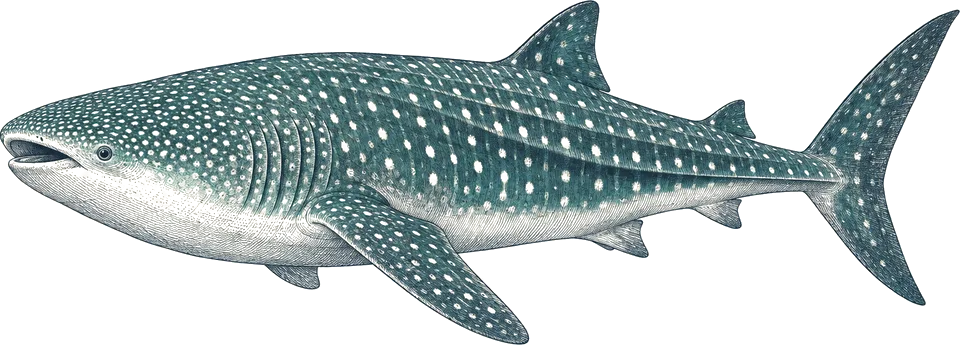
Western Rocky, High Rock
Scan the blue on safety stops around offshore rocks; do not chase.3
Occasional; February to May.
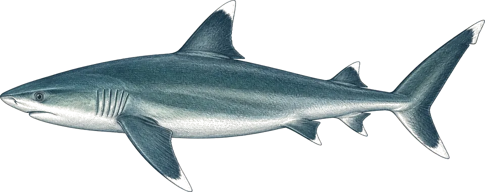
Burma Banks, Black Rock
Hang near the bank edge where the shelf drops into deep water.3
Likely at the Banks, fewer than in the 1990s.
Shark Cave, Western Rocky
Look under ledges and inside caves; approach slowly and do not block exits.5
Regular in the caves.
Compiled from the sources above, last checked 2026-11-12. Monthly conditions come from our own climate records; see how we score.